Visits to the Castor River
Visits to Branches of the Castor River

On 26 June 2020, 10h13, air temperature 24°C, sunny, Beaufort gentle breeze, we set out to check the three branches of the Castor River for Molluscs, and for whatever else. We'd found a nice variety of Unionid mussels at the Little Castor at Rte 400 last fall, and had a nice variety on the main Castor below Russell in 2000, so the upstream branches were a surprising disappointment – a strange mixture of clay and angular rocks, a long brushy way below their bridges. Beavers were conspicuous by their absence. The main Castor below the Russell weir was totally overwhelmed with the Viviperus Mystery Snails which had first showed up there in 2012, but we didn't find them in any of the upstream branches. Kilometrage for this trip was covered by our Ottawa Field Naturalists Club research grant. Quotes in italics are directly from the database narrative output from which this account is edited down.
We were late for an appointment, so our outbound stops were brief: Barn and our first certain Cliff swallows where County Road 20 crosses Kemptville Creek, an observation of three big rolls of plastic 'tile' drains on trailers where some woods nearby have been cleared of forest, minimal or no Turtle nesting in new gravel where County Road 20 crosses the North Branch of the South Nation River 1.1 km ENE East Oxford, at a new culvert where the north slope is largely rip-rap of broken rock. The pool below the culvert was dotted with yellow Bladderwort blooms and a small Parsnip plant was the first we’ve seen in flowering this year.
Then up Highway 416, where we confirmed last year’s observation of a strangely isolated stand of Japanese Knotweed 4.33 km NNE Kemptville on the “grassy superhighway roadside,” and River Road where a predated nest confirmed Snapping Turtle nesting along a fisher-trampled roadside, Milkweed was in bloom, and the heads of Narrow-leaved Cattail were about to begin to shed their pollen. On Dalmeny Road a young-looking Red Squirrel was crushed in midlane, and we saw our first blooming Chickory on Stagecoach Road, and then had to stop to identify a road-killed Guineafowl.
At 4.03 km ENE Enniskerry, still rushing, we passed up our first crossing of a branch of the Castor, where Snake Island Road crosses the Middle Castor, as a “narrow stream near homesites & agricultural fields,” and wickedly narrow road shoulders meant there was no place to park the car. We did stop for the North Castor at Yorks Corners Road, 5.61 km NNE Metcalfe, to find a crushed Painted Turtle and shreds of her eggshells, and Fred walked back to the “slow muddy stream with marshy backwaters through plantation woods & fields,” but didn’t go down to the stream since there were no exposed banks. There was a bit of Snapping Turtle-digging by the bridge, Yellow Waterlilies were in bloom, there was Bur-reed along the stream, and a female Wood Duck with two small ducklings in the marshy backwater.
Then 2.20km NE of there, at Cooper Hill Road, we saw a manifestation of the capitalistic wisdom of pesticide salesmen, where a narrow ditch along the brushy roadside edge of tall-tree Aspen woods had been sprayed with herbicide. As usual with such spraying there was no Parsnip – the nominal target of the poisoning – to be seen, here it was mostly Poison Ivy and Field Horsetail in the ditch, and a variety of shrubs with browned-off foliage.
Then into Prescott & Russell County, where we visited in the yard of a friend, beside a garden as dry as ours at home, discussing covid-19 & gardens & Quarry Lake plans. There was a minor sprinkle of rain, a Turkey Vulture overhead, a bright green Tetraploid Gray Treefrog on a chair, a Flicker pecking at Ants in the lawn, and Phoebes calling around a traditional nest site.
After the meeting we headed down Eadie Road along the fenced off old red brick quarry, astonished at seeing a greater density of Yellow Sweet-clover than we’d seen in our surveys anywhere east of Alberta. There was no evidence of Turtle nesting on either side of the road in three slow drivebys, lots of Parsnip in bloom, and Narrow-leaved Cattail shedding pollen.
We got down to the main Castor River below the Russell Weir where Viviparus ‘georgianus,’ Banded Mystery Snails were just about the only species in the one patch of drift we found... the shores were ennobled by patches of Saururus cernuus, Lizard's-tail, which we’ve found more commonly along the Castor than anywhere else, and the Duckweed was the always-charming Spirodela polyrhiza. Unionid mussels were represented by a few shells of Pyganodon grandis, the species we’ve usually found here. The widspread-in-the-Nation-basin Flowering-rush was in bloom, and one stalk of the lovely pink flowers was more than a metre tall. Just as one wishes one were a bryologist or lichenologist in the woods of New Brunswick, this was the kind of place where one wishes one were a phycologist because algae were everywhere. Our samples of the algae that matted all across the river below the weir may have been the same species as the floating yellow mats covering much of the width of the impounded river above the weir.
After Aleta took photos of, and cell-phoned them to, a mother & toddler daughter picnicking but not daunted by rain showers on the lawn above the weir, we went to the Middle Castor at Victoria St, 4.28 km W Russell. Here there was a characteristic, but instructive, horror of the season, a dead & bloated female Snapping Turtle, ornamented with Fly eggs, on the midspan of the bridge beside one impact-extruded egg.

Fred went down the steep slope of the embankment, past little triangular-leaved Atriplex hastata (Orach) on rocks under the bridge, and then waded across at signs of a natural gas pipeline crossing. There were Pigeons and their droppings under the bridge, a very few Green Frog calls, Raccoon tracks along the water's edge, and a bit of Cottonwood fluff in the air.
There was no concentrated shelly drift, but he picked up Helisoma trivolvus (Larger Eastern Ramshorn) shells to document that there were no Banded Mystery Snails here (there were no Mystery Snails upstream of Russell in any of the branches, and also no Lizard’s-tail). Mussels were four living Elliptio complanata seen alive while he was wading under the bridge, and one Pyganodon grandis shell.

Our next stop was the Middle Castor River at 9th Line Road, 2.22 km E Metcalfe a “small meandering clay-bed marshy/muddy river, wooded area along agricultural fields.” We’ve often wanted to stop here on our way to Castor River Farm to pick up our supply of Oats. This visit was a complete malacological failure, with “NO:Unionidae and NO:Gastropoda seen in what could be walked of the shores on both sides of the bridge. This stream would need to be done by canoe, since the banks are steep and very hard to walk along. Both Nymphaea odorata (Fragrant White Water-lily) and Nuphar variegatum (Yellow Water-lily) in bloom in the stream. The sloppy mud under the bridge is completely tracked by Procyon lotor (Raccoon) and lots of tracks along the shores elsewhere.” Fred saw a tiny newly transformed American Toad along the bank near the water.
Notable plants included Manitoba Maples along the stream with Ashes dying back from the ravages of the Emerald Ash Borer, a magnificent Bur Oak at the edge of a homesite lawn, Prickly-Ash in the streamside thickets, a poddy metre-tall stand of Garlic Mustard in woods SW of the bridge, Purple Loosestrife plants deformed & perforated by Galerucella biocontrol Beetles, a dense stand of Spotted Jewelweed seedlings, scattered forageable Broad-leaved Cattail stalks above the bridge, and Crown-vetch in bloom tangled among Orange Daylilies near a Hawthorn bush on the slope down from bridge and lane down towards the river. Also “Cannabis sativa (Hemp). 1 herb, specimen. circa 30 cm tall, on edge of road shoulder." The most striking Bird was a Virginia Rail briefly out in the open above the bridge, and only the second Eastern Kingbird we’ve seen this year. Red-winged Blackbirds, Eastern Phoebes, Cedar Waxwings, Goldfinches, and Blackcap Chickadees were also around.

 Then we went to the “South Castor River along 9th Line Road, 4.33 km NE Vernon. (20m waypoint), 45.18342° N 75.41711° W TIME: 18h14. AIR TEMP: 25°C, cloudy, calm. HABITAT: muddy clay-rocky small river in wooded valley through agricultural fields. 2020/164/ba, visit(event). natural history, walk. WAYPT/Y063, S end of visit at new rip-rapped culvert. Not clear if this is from the road, or more likely from tile drainage of the field across the road.
Aleta: We backed into a field a ways past the bridge, and walked back along the road but before we reached the bridge we found a loop of the river paralleled the road. Climbed down at a culvert. Steep clay banks, like a green tunnel, overarched by sinuous, elbowed Acer negundo (Manitoba Maple) -
Fred waded 108m downstream for about 10 minutes, reporting brutally steep banks that looked artificially channelized... “and the west side looks more workable than the east where I am walking. Amelanchier(Shadblow) in green fruit hanging over the shore in places, few Odocoileus virginianus (Whitetail Deer) and Procyon lotor (Raccoon) tracks. Lemna minor (Common Duckweed) (not a lot) is the Duckweed. NO:Mollusca seen but hard to look into the water due to turbidity & sky glare, and no place for drift to be deposited.”
“South Castor River along 9th Line Road, 4.35 km NE Vernon. (20m waypoint), 45.18430° N 75.41770° W TIME: 18h24. AIR TEMP: 25°C, cloudy, calm. HABITAT: muddy clay-rocky small river in wooded valley through agricultural fields. OBSERVER: Frederick W. Schueler. 2020/164/bm, Elliptio complanata(Eastern Elliptio) (Mollusca). 1 shell, specimen. WAYPT/Y064, 75 mm not-fresh valve beside rock I sat on to write NO:Mollusca notes at N end of visit - up the brushy nearly vertical bank to the road from here.Where 9th Line road crosses the river, 4.40 km NE Vernon, there was no Turtle nest-digging on the asphalty roadsides of the bridge ,which were isolated by black silt fencing, so any nesters would have needed to come into the shoulder from the road. There was a ruined Barn Swallow housing unit on a pole, which presumably dates from the same bridge repair as the fencing (often-neglected regulations require that this fencing be removed after the vegetation has grown up after the road work is done). Again there was a small patch of Garlic Mustard on a silt-fenced patch of asphalty roadside SW of the bridge, and another single small Hemp plant on the edge of the road shoulder."

We drove past the South Castor River/Marionville Road, 2.70 km S Vernon, because it was a “ditchlike muddy claybed stream in cornfields” but stopped a ways upstream where it crosses Belmeade Road, from the north, 4.89 km SW Vernon as a “rocky shallow creek among agricultural fields - maybe this is a brook rather than a creek?”.
A tractor was spraying what looked like herbicide on a Soy field to the SW, there was no Turtle nest- digging around the bridge, and a headless Savannah Sparrow on the roadside.

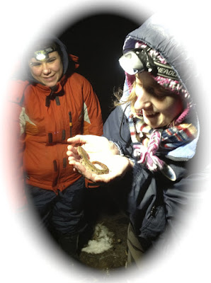
Fred waded upstream (downstream may have been better) finding small Pyganodon shells wedged in among the streambed rocks, a fragment of a Strophitus undulatus shell, and some drifted snails on water-level sand under the bridge.

Then light levels were getting towards dusk, and we headed homewards, through Reids Mills and Hallville, photographs of “sunlight through clouds over cornfields & woods,” - Catalpa trees in bloom, and not finding Xerolenta obvia snails on interchanges of Highway 416. Given the intensely agricultural character of the land-use, it’s disappointing but not surprising that the upstream branches of the Castor River have such a meagre Unionid fauna. Our next steps will need to be doing more bridges on the Little Castor, and returning to previously sampled sites along the main river below Russell, to see how Mystery Snails, or other changed conditions, have affected things there.
Suggested citation: Schueler, Frederick W., & Aleta Karstad. 2020.Visits to Branches of the Castor River, posted on 16 July 2020 on http://www.doingnaturalhistory.com/2020/07/visits-to-castor-river.html


The Castor River and it's upstream branches are all highly polluted with the field run-off from the 90,000 annual wet tonnes of Ottawa's concentrated sewage sludge "biosolids", that are gotten rid of as "free fertilizer" for corn crops. At the rate of 10 wet (90% water) tonnes applied per acre to provide sufficient nitrogen for the corn there is 8 times more phosphorus than the corn plants can use.
ReplyDeleteWhen the sludge is aerially spread and disked in prior to planting there is still 10% remaining on the surface, and the sludge that is disked in can leach out through the field drainage tiles as well. The excess phosphorus in the leachate is the likely cause of the increasing algae growths!
The sludge is permitted to contain 2 million e-coli per 100 ml sample, and Ottawa's routinely has 1.5 million e-coli per sample. Ottawa and the MOE refuse to test the field drains and side ditches from the sewage spread fields that empty into the Castor River, but the two samples I took after a rain found 800 e-coli in one, and more than 4000 in another (it exceeded the test limit!).
The sludge is also 30% composed by dry weight of some 90,000 industrial chemicals which aren't tested for and which are interacting with the soil chemicals and each other to produce ever more chemicals with unknown effects on the natural environment. The sludge is also being spread on fields near Vernon that are flooded by the South Castor river in Spring snow melt, since there are no regulations to prevent spreading sewage on flood plains!
This sewage spreading has been going on for over 20 years now, which could explain missing diversity of life in the river systems across North America where this has been happening!